MONTECITO (MTC) Data Station
Updated 7/2013
http://cdec.water.ca.gov/cgi-progs/queryF?s=mtc Department of Water
Resources
http://mesowest.utah.edu/cgi-bin/droman/meso_base.cgi?unit=0&timetype=LOCAL&stn=MTIC1
University of Utah
http://www.wrh.noaa.gov/mesowest/getobext.php?wfo=mso&sid=MTIC1&num=48&raw=0&banner=off
NOAA
The Montecito Data Reporting Station is located at 1,619 feet in the foothills above Montecito.
Latitude 34.461397, Longitude -119.649014 (Data Reported by University of
Utah)
The CA Department of water resources reports a slightly different location
Located at elevation 1500 feet. Latitude 34.46, Longitude -119.643.
http://cdec.water.ca.gov/cgi-progs/stamap?MTC
Looking at the coordinates with Google Earth (image below), it appears that the
MOSWest coordinates from the University of Utah are more accurate.
MTC will experience more
drainage wind from the north than other locations that are more protected.
If you are concerned about potential north drainage wind, check the MTC
observation.
Note: when there is north drainage wind, the station seems to report very high
wind speeds. Not sure these speeds are accurate. They tend to be
higher than anything else around. They will typically indicate 40 when La Cumbre is only indicating 25.
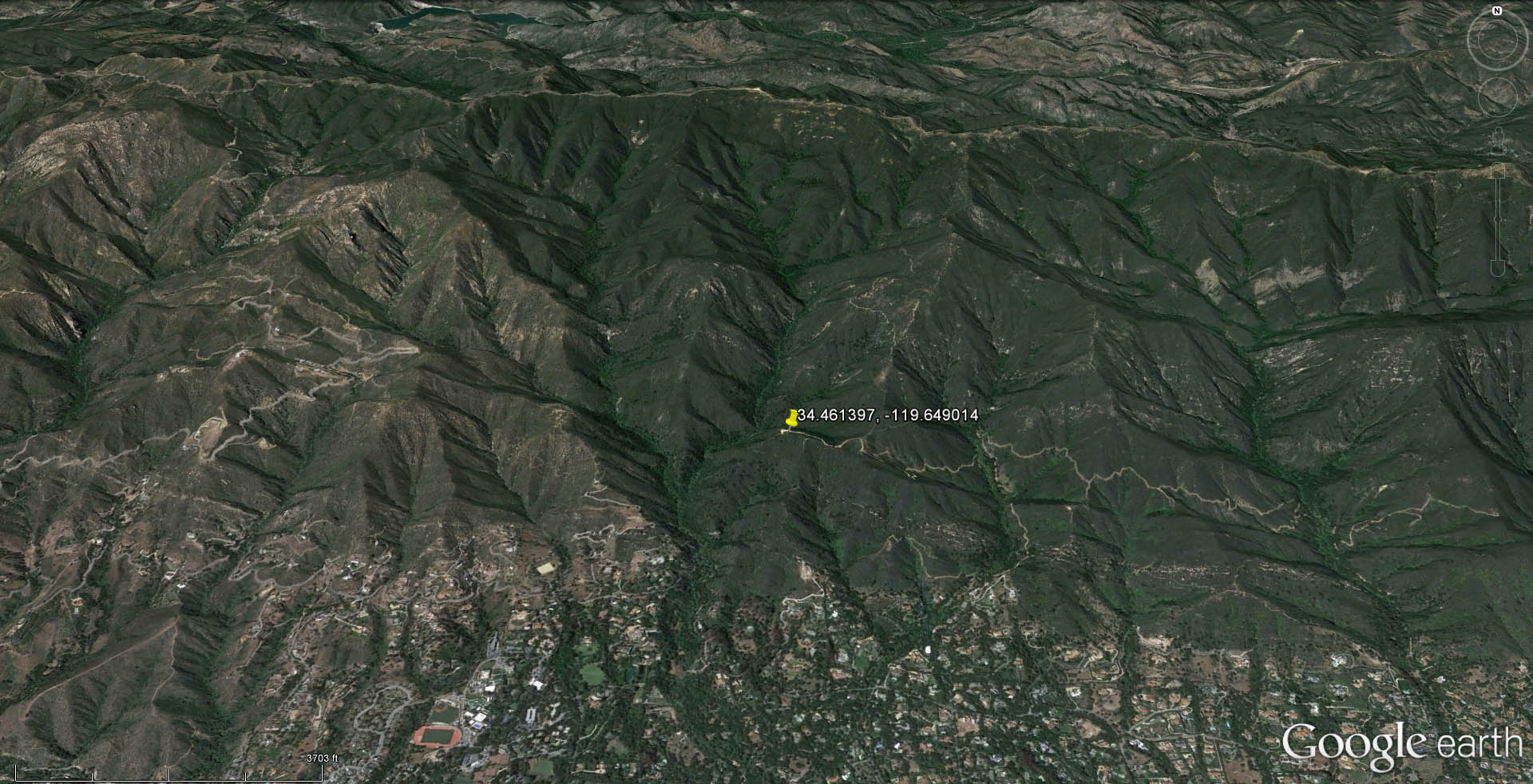
Montecito reporting station located on the SW bump below the SW spine of
Montecito Peak. [Click] for full size
image or
[Click] to open KML file with Google Earth (need to have
Google Earth loaded on your computer to fly to the place mark for the Montecito
Station)
Note: open KML file when prompted, (might need to authorize "open" twice") but
saving place mark data on exit from Google Earth is optional
(to avoid excess clutter, I don't recommend saving place mark on exit from
Google Earth).