
Although you could not see the thermals themselves you could easily find the best potencial sources of thermals kilometers away before you reach them because this is an optical instrument (a camera), not dependent on distance.
This is a link to a video I record days ago to show that it really works and helps to know where the thermals are.
http://youtube.com/watch?v=97HMCCwa3BE
The video shows the before, using a normal camera, and after using a thermal camera over the same area. The Red areas show where the ground is hotter.
After some experimentation I recon that these areas are indeed the ones with the higher thermals.
A thermal camera is nowadays cheap (about 250 dollars) and can be adapted to a smartphone.
There are many brands. I am using the FLIR ONE from FLIR systems with MSX technology (dual camera, one thermal, one normal, superimpose both to see the details of the image and thermal beacons).
I havent seen anyone yet to use it as a flight instrument maybe because a few years ago it would cost 10 000 dollars.
I think, in my own opinion, this is a very nice information to have in flight. If you go flying to an unknow place where you dont know nothing about it, seeing possible thermal areas 10 km away while in XC flying is incrementing your possibility of a greater distance flight.
I have testing it for 2 or 3 months now. I tested it in many situations. I get a very good degree of assurance with it. The reading experience is getting better and better.
The background sound is from my altivario (I use FLYME app for centering Thermals).
I use an extension cord for fixing the thermal camera in the wing risers and connect it to my samsung galaxy S6 smartphone in dual screen to use the FLIR App and XCSoar for the flight.
Of course in a windy thermal place the termal is not directly above the site but I can get the general view of the thermal sources many miles away. And the camera can be callibrated to a certain temperature variation .
When the altivarios appeared many people commented it would kill the sport. Nowadays everybody is reliyng on it and the 100+ miles flghts people are doing is now not only related to the wings but also on the many flight instruments we use today.
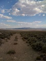
This video was recorded on the 4th July 2016 in Serra da Lousã, Portugal, at about 1200 meters MSL.
Please comment.
Your opinions on the subject will be helpful.