Chirs Clontz wrote:... Do you have any weather condition tips and/or safety tips for launching Pine Mountain in Ojai during mid-afternoon (10:30AM-noon) in the summer? ...
Chris, good morning.
I’ll try to post something more useful in the next week or 2, but just a few brief notes.
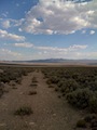
Pine is an omni directional flying site that sits at the juncture of multiple competing airmass. It is high, above the marine layer, and a stepping stone to the high meadows which can be good flat land thermal zones.
Mid-summer, the inland thermal draw is usually dominant resulting in too much midday wind from the south for PGs. The wind is feeding the inland thermal draw. You want to pick days that have a little north in the winds aloft forecast that can resist the inland draw. Most of the long distance flights from Pine are late Summer as the inland draw starts to relax from mid-August through September. Late spring and early summer (May through mid-June-ish) also sometimes yield less wind from the south.
Flight routes vary depending on the day. You can run the range low SB style 6 miles to Decision Point and back, or continue on across the “Chute” to Thorne Point (11 miles, not as easy to cross back), but most long distance flights are on days with big altitude where you want to think like a buzzard and zig along the meandering convergence seams. Lockwood Valley (high valley meadow) is the main draw and will pull from all directions down low.
Crossing I-5 is the biggest obstacle, and more problematic with increasing wind from the south. Going east across the Antelope Valley will vary depending on the day. Some days you will be on the south side, others the north, often down the middle, but most days you will need to angle northeast prior to reaching the more stable filling flow coming up the Santa Clara River (about midway between I-5 and Hwy 14). Late in the season you can sometimes go south of Edwards AFB, but most days you will be pushed north of the base.
Pine is often not flyable for PGs mid-day mid-summer due to the south wind but works better for HGs because they are faster.
Ojai is more reliable and soarable most days, but is usually below the big altitude threshold (it is in the more laminar filling flow that feeds the higher terrain to the north). The distance potential is limited unless you are willing to continue OTB behind the Topa Bluffs into the non-retrievable wilderness (toward Devils Heart). You can usually reach Fillmore, and on occasion connect to the desert along the Santa Clara River route, but the summer river air is relatively cold and heavy so it is rare to go much past Fillmore.
Upper Ojai acts like a mini Lockwood Valley and draws in from both directions. About 1500 feet, it is the locally high meadow and will often yield the “Upper Ojai Convergence” toward the east end. The Bluffs are scenic but can be intimidating midday. Later in the day you can top land at the Bluffs, but I wouldn’t want to walk down. Chiefs Launch is a pretty easy top landing spot.
http://paraglide.net/log/2013/13_11-24/jpg/2013_11-24f_chiefs_launch.jpgOjai is a little inland, but not as much as Marshall. It is influenced by the marine air coming up the Ventura River. Marshall tends to work good late in the day, but Ojai will often work better earlier before the marine air fills in. Most pilots will plug upwind down-hill toward Nordhoff, which is usually toward more stable river air, but I recommend reaching eastbound uphill toward the Bluffs, away from the filling flow. The Topa Bluffs are a detour when racing on a short clock from Santa Barbara, but launching from Chiefs in the summer the course is limited so you have plenty of time to poke around and test for max altitude at the Topa Bluffs.
Going OTB from the Bluffs likely works on good days, but I’ve only done it a few times because it is into wilderness and I don’t have the ability to hike out.
http://paraglide.net/log/2014/09-14/1_nuthouse_past_garlock_111_mi.htmYou can also reach back toward Thorne Point, Pine, or the Watershed Divide Convergence, but you will need a good day to make those connections.
Santa Anna events tend to be spring and fall, but we did get a hurricane a couple summers ago that offered some unstable east flow in July
http://paraglide.net/log/2015/07-19/1_fillmore_to_santa_ynez_67_mi.htm 
Tom Truax | aka SD / Sundowner
