
Pine to North of Cal City 82 miles
Moderator: Moderation Team
1 post
• Page 1 of 1
Pine to North of Cal City 82 miles
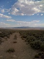
![]() by Tony Deleo » Mon Aug 31, 2009 8:50 pm
by Tony Deleo » Mon Aug 31, 2009 8:50 pm
Cycles at ttake off were anywhere from 3-25 mph out of the south-southwest. Had to fish around west of takeoff before I connected on the west side of the spine west of takeoff. The winds at altitude were 18-20 out of the southwest. Climbing out to 14k I went on glide to FRazier @ 65-70 mph. At the west end of Frazier I went to 16k. The shear line bowed out to The Libres. Flying downwind to the Libres at 80-85 ground speed and losing 4k ft. I entered what was a "ratty" convergence. From the Libres the shear line turned north east towards the Silver Queen Mine at the intersection of 138 and 170 I went to 16500', passing over the Silver Queen Mine the thermals were drifting out of the west over Edwards. My plan was to head northeast to Telescope Peak on The Panamint Range and then on to Beatty or Tonopah. Unfortunately as soon as the clouds ended the lift ended. The west/north west winds out of Tehacapi washed out everything in its lee. Over Cal City and low with the thermals drifting out of the northwest. I headed north bound with 7k. The shear line was defined by the smoke was extending from near Llano towards Barstow. I landed midway beween Cal City and the Honda test track, one thermal short of 100 mi, and waited in the 15-25 mph winds as the winds punished my glider.
-
Tony Deleo - Posts: 86
- Joined: Mon Jun 23, 2008 1:07 pm
1 post
• Page 1 of 1
Who is online
Users browsing this forum: No registered users and 2 guests